
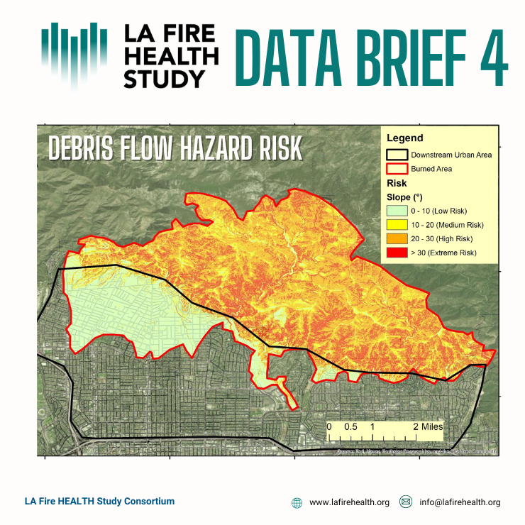
The latest Data Brief from the LA Fire HEALTH Study uses mapping and modeling tools to look at how a wildfire impacts the risks of mudslides during extreme rains.
This work does NOT have immediate action items or cause for concern for the public, but instead helps city officials, planners, and others understand that many types of impacts from urban wildfires, and start to think about ways to mitigate risks in the future. Run-off mapping can also help to predict risk of mudslides and debris flow events triggered by extreme rains, and help to improve evacuation planning.
Key Takeaways:
- The last decade of California’s cycle of climate extremes including wildfires and extreme precipitation had led to increased risk of mudslides, especially in areas that were affected by the wildfires.
- City officials should use these maps to deploy resources to prevent mudslides and flooding in the event of extreme rains.